Environment Monitoring
Ground Stability Monitoring
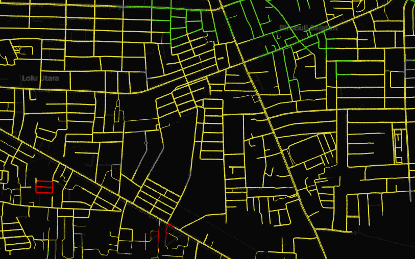 During my tenure at Geoinformatics Center, I was involved in a project that focused on monitoring ground stability and the reconstruction process in the Palu region of Indonesia, which was devastated by a massive earthquake in September 2018. The project utilized Persistence Scatter (PS)-InSAR products based on Sentinel-1 data, processed from the Geohazard Exploitation Platform (GEP), to gather ground motion information. Based on this data, I conducted an assessment of the stability of critical infrastructure such as roads, buildings, and canals for ongoing monitoring purposes in the region.
Project: Support for Emergency Assistance on Rehabilitation and Reconstruction in Central Sulawesi, Indonesia. Check out the generated stability layers from this project portal Link!.
Forest Biomass Estimation
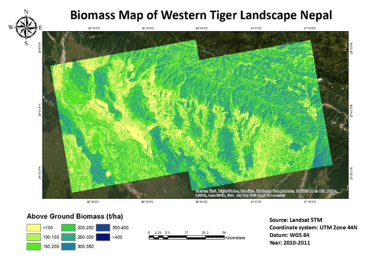 During my tenure at Asian Institute of Technology, I conducted a research on estimating forest biomass in the Western Tiger Landscape of Nepal through the utilization of a satellite remote sensing approach, which incorporated synthetic aperture radar and optical data fusion techniques (ALOS PALSAR/Landsat). To achieve accurate results, a random forest algorithm-based model was developed utilizing various parameters such as radar backscatter, texture parameters, vegetation indexes, and topographic features. The aforementioned factors were utilized to predict and provide reliable estimations for the final biomass results.
Access the case study Here!.
Crop Health Monitoring
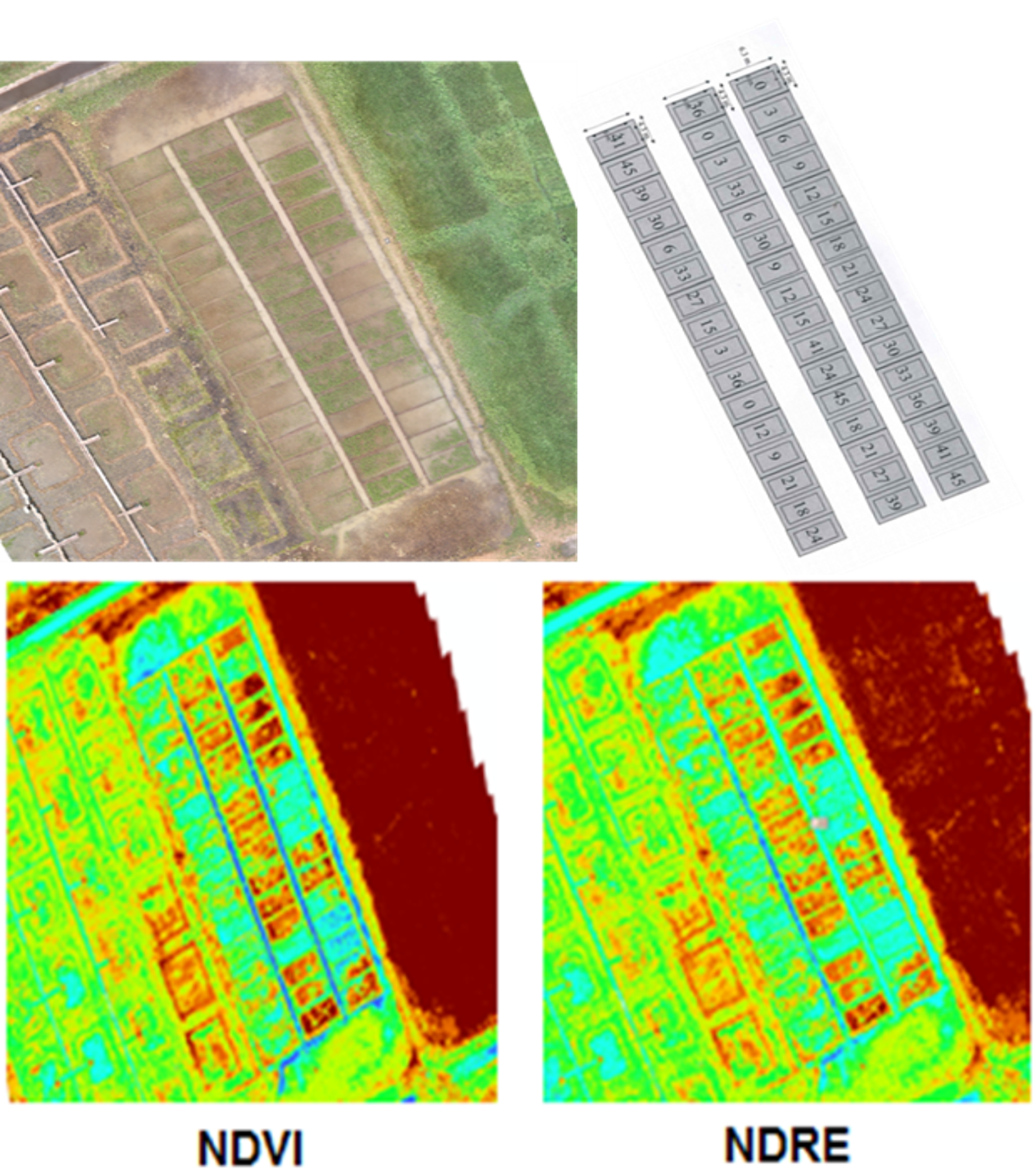 The Geoinformatics Center(GIC), in collaboration with the Ayutthaya Rice Research Center in Thailand, undertook a study to examine the correlation between plant nitrogen content and vegetation indexes through the integration of low-cost drones. This research aims to identify nitrogen deficiency, which is a key factor in low yield production in rice plants. As part of my internship, I worked alongside the GIC group to determine the nitrogen levels of rice by analyzing multispectral images acquired from drones equipped with a Parrot Sequoia multispectral sensor and a DJI Phantom 3. Our research aimed to assess the feasibility of low-cost drones as a scouting tool for paddy fields.