Extra Activities
IWG-SEM
As a member of the International Working Group on Satellite-based Emergency Mapping (IWG-SEM), a collective of voluntary organizations specializing in satellite-based emergency mapping, I actively participated in advancing cooperation, communication, and professional standards within the global network of emergency mapping providers. Through this membership, I was able to share and exchange best practices and guidelines for disaster mapping activities, particularly within the Sentinel Asia community.
Access Emergency Mapping Guidelines introduce by IWG-SEM Here!.
UR Field Lab
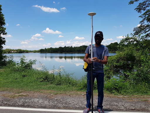 In 2019, I had the privilege of serving as a volunteer in the Chiang Mai Flood Lab, which was organized by CO-RISK Lab and the World Bank. My role in the event was to act as a resource person, providing guidance on the efficient use of Unmanned Aerial Vehicles (UAVs) during times of disaster. The primary focus of the lab was on creating disaster vulnerability maps and supporting relief efforts during the post-disaster phase by utilizing cutting-edge technology. Here!.
Humanitarian OpenStreetMap Team
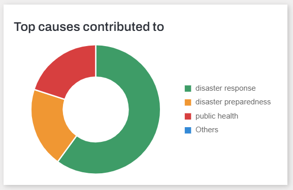 The aim of the Humanitarian OpenStreetMap is to partition large mapping projects into smaller, more manageable tasks that can be executed quickly and cooperatively by a diverse group of individuals working towards a common humanitarian goal. This approach is particularly effective in times of disaster and crisis, when a rapid response is necessary. As an Intermediate mapper of the Humanitarian OpenStreetMap Team, I have had the privilege of contributing to humanitarian relief efforts outside of Southeast Asia. This experience has provided me with a valuable opportunity to make a meaningful impact and help those in need during times of crisis.