Surveying and Mapping
Geodetic Triangulation
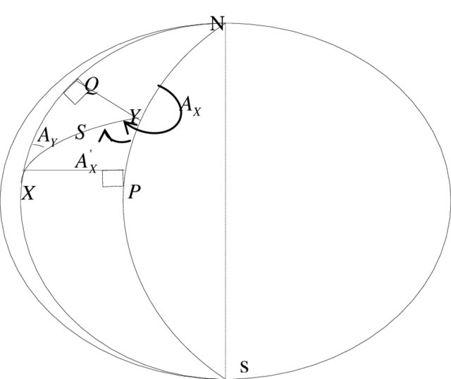 During my undergraduate program, I engaged in establishing a highly-accurate control network utilizing the First Order Control Point Network of Sri Lanka. To conduct a comparative study, we examined new controls employing both triangulation and GPS methods. We obtained angle observations from precise theodolites and applied them in calculations using the mid-latitude formulae. Ultimately, we adjusted the network through the method of variation of parameters. This undertaking served as a practical example in contrasting traditional surveying methodologies with contemporary, state-of-the-art approaches.
Access the project report Here!.
Drone Mappping + GNSS Surveying
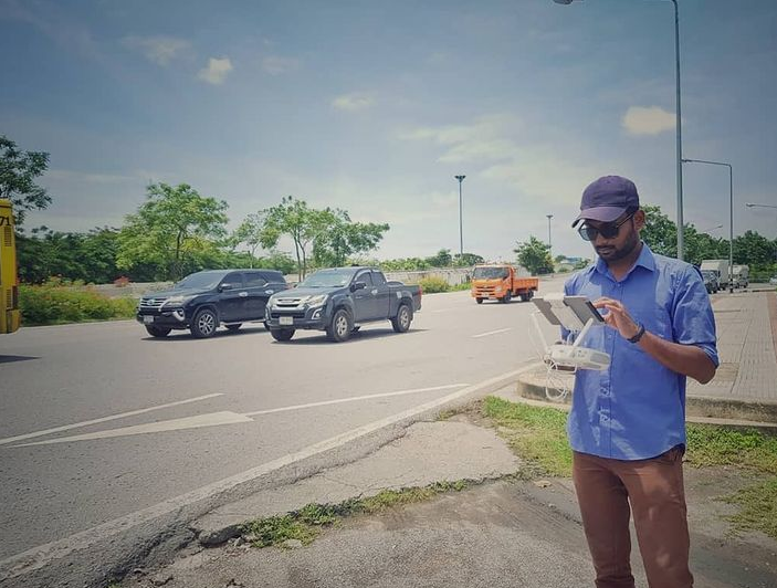 During my tenure at the Geoinformatics Center, I actively participated in numerous drone surveying endeavors for diverse applications. These included the creation of high-resolution ortho-maps, crop health monitoring, object detection, and construction monitoring. Additionally, I possess expertise in the acquisition of RGB/Multispectral sensor data, coupled with high-precision positional information, utilizing advanced positioning methods such as Real Time Kinematic, Network RTK, and Precise Point Positioning.
Road Construction Monitoring
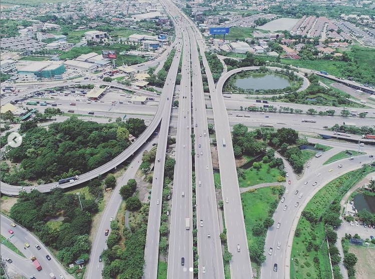 The Department of Highways (DOH) in Thailand is a government agency dedicated to overseeing the country's highway networks. Recently, DOH launched a road expansion project on the Rama 2 Highway in the Samut Sakhon province. To aid in this initiative, the Geoinformatics Centre at the Asian Institute of Technology (AIT) collaborated with DOH to provide the latest maps depicting the construction status of the targeted road. To accomplish this, our GIC team was tasked with conducting real-time kinematic (RTK) surveys to obtain ground control points. These were then integrated with drone data to produce highly accurate and high-resolution ortho map products.
Access the live maps of this project Here!.
3D Modelling
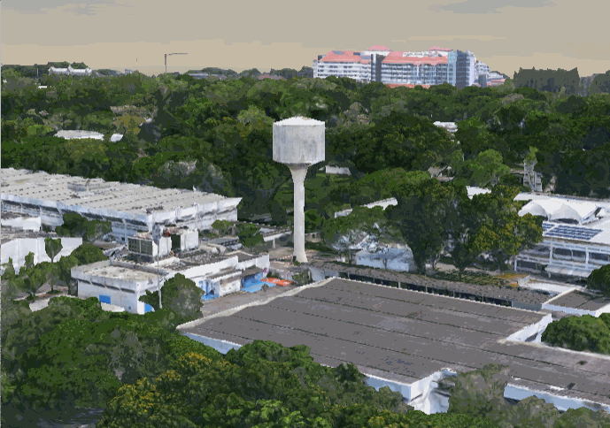 During my tenure as an intern at the Asian Institute of Technology, I had the opportunity to make significant contributions to a group project aimed at enhancing the efficiency of campus management through the development of a cutting-edge 3D model. My responsibilities included undertaking the acquisition, processing, and visualization of data obtained through the use of a DJI Phantom 3 Drone, in conjunction with the advanced Bentley Context Capture software.
Access the live 3D Model Here!.